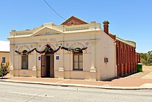
Shire of Pingelly
Local government area in Wheatbelt region of Western AustraliaThe Shire of Pingelly is a local government area in the Wheatbelt region of Western Australia, about 160 kilometres (99 mi) southeast of the state capital, Perth, between the Shires of Brookton and Cuballing along the Great Southern Highway. The Shire covers an area of 1,295 square kilometres (500 sq mi), and its seat of government is the town of Pingelly.
Read article
Top Questions
AI generatedMore questions


